Source 2 Sea 4 charity (S2C) - July 2006

This blog was created for our Source 2 Sea challenge (the length of the Thames) which we're doing during the first week in July 2006. If you're interested in my earlier challenges, please click on the 'View my Complete Profile' button and you'll see a list of what I've done. Thanks for your support, Colin.

Sunday, July 16, 2006

Some facts and figures.

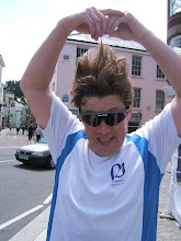
Now that we've been back a week and have had the oportunity to recover somewhat, I'd like to give you a bit of a brain dump of the highlights of the trip, they may not have been so at the time, but looking back on them, they're the things I won't forget in a hurry!

  • Firstly, and most importantly, we've raised over £6,000 for charity, if you'd like to donate and haven't done so already or would like to increase your pledge, please drop me an email (colin.bycroft@affiniti.com), or call me (01442 883205), or leave a comment here.
  • We only started canoeing in May, and so have done exceptionally well to complete such an undertaking.
  • We walked 12.5 miles (including, in my case, an unplanned tour of Cricklade), kayaked 138 miles & cycled 92 miles (a similarly unplanned tour of Northfleet didn't help!)
  • The managaress of Northfleet Sainsburys gave us a bottle of champagne to finish the challenge with - Thank you.
  • People we met in pubs and locks donated £22 while we were en route.
  • Gordon was attacked by a swan, it got on the back of his kayak and was hissing and flapping its wings while he was paddling like crazy to get away.
  • A number of swans 'warned' us to stay away from their cygnets
  • There are some absolutely amazing houses on the banks of the river........ but I suppose Windsor Castle has to take the biscuit.
  • It was 31 - 32 degrees C for the first few days (there was a 'heat' warning announced on the radio on Monday.
  • There was an electrical storm on Wednesday morning and the temperature fell to around 18C from then on.
  • Only Tony didn't capsize, I went twice, Gary nearly got away with it........ but went in the end.
  • Cycling through central London was interesting, I had a bout of road rage with a cab.
  • We lost Gordon when he followed a pretty girl rather than the person in front.
  • We had a real problem finding Warden Point, we even knocked on doors and were given conflicting information, in the end it was a fisherman who'd lived there man and boy that gave us the exact spot.
  • We found some cray fish in crayfish pots.
  • The longest day from getting on the water to finally getting off it was 15 hours.
  • The earliest we were on the river was 07:15
  • My fingers swelled to almost twice their usual size.
  • My toes were red raw (see the earlier photos if you don't belive me)
    I had huge blisters on both feet and on all my fingers (again, if you're perverse, see the photos)
  • My right hand lost most of its mobility, it was constantly gripping the paddle - even when there was no paddle required. It was great for carrying drinks from the bar (the few times we were back early enough to get there) as I just forced my fingers over the rim of the glass and it locked on, like the cranes you get in amusement arcades.
  • Don't anybody ask how my 'holiday' went as I reserve the right to lump you one if you do.
  • Did I mention we raised more than £6,000!
  • Read further down this blog if you want more info or would like to see our photos.

Google Earth (TM) and other things


The above screenshot is from Google Earth, I realise I 've been banging on about it but people who don't have it won't know what I'm on about. Google Earth (TM) is a library of satellite images that you can easily display on your computer if you're connected to the Internet. Some of them, particularly over well populated places, are very detailed - as you can see above. It's Teddington Lock and the Angler's Inn pub.

The GPS I have (now faulty but I've ordered its replacement!) can upload tracks to Google Earth and overlay them on the images (the red line), well I'm impressed by it all! The following link takes you off to a couple of images and includes some commentary about why we we hid under the foot bridge.....

http://www.salemfc.org/s2c/files/Photos/Google%20Earth%20screenshots/

Tuesday, July 11, 2006

Some photo's (don't worry, not many) and some blisters!!

I've now consolidated all our photos and taken some of the best out to present here; don't worry there's not lots and some are quite humerous - if you enjoy other people's misfortune anyway. See them here:

http://www.salemfc.org/s2c/files/Photos/Source%202%20Sea%204%20Charity%20-%201st%20-%207th%20July%2006/


If you're really perverse you can see what I had to put up with (no, I don't mean the other five team members!) - in the way of blisters. I suppose you could say it's me that's perverse showing them off in this way but hey ho, I'm hoping you may decide to increase your sponsorship in sympathy. It's dead easy, drop me a mail or call me, I'll happily pass on sponsorship to any of the charities we're supporting (Breast Cancer Research, Cancer Research UK, CLIC Sargent, Heart Research UK, Parkinson's Disease Society and 37 Camelot Way mini bus appeal) or a split across them all.

For you people that like to see what I mean when I say I had blisters the size of £5 notes, look here:

http://www.salemfc.org/s2c/files/Photos/Colins%20blisters/


Finally for this posting, I've put the Google Earth script for the complete journey (minus the last day remember) in a zip file on its own to make it a bit easier, just go to the link and open the zip file when prompted, double click on the file that's in there and prepare yourself to be amazed (if you have Google Earth!!), you can zoom in and see where we walked back and forth around locks and all the toing and froing when we had lunch etc. you can also see where we went wrong when cycling and ended up going round in one big circle (oops!) Here's the link:

http://www.salemfc.org/s2c/files/combined%20S2C%20tracks.zip

I promise I'll add some more detail about the journey itself in another posting (at the weekend), including how Gordon (photo above) was mounted by a swan and how Tony was the only person that didn't capsize - see, I'll bet the others didn't own up to you that they had a swim did they......

Actually, talking about Gordon........... unfortunately, when he was applying for his Thames license (which has to be stuck to your boat at all times so it is visible to lock keepers), there was a bit of a typo took place and he had to paddle down the river answering to Gorgon Wood. I know his hair got a bit straggly at times but I never heard it hissing! Posted by Picasa

Sunday, July 09, 2006

after the event stuff.....


I've exported the GPS data to Motion Based and Google Earth. Unfortunately some information has been lost for Tuesday and Wednesday mornings, also, as I suspected, we have nothing for Friday as the GPS packed up completely. It's a real pity, it's given sterling service but I can understand it wouldn't like being drowned , I mean, I didn't particularly enjoy it, especially the second time!

The combined Motion Based file is here for Saturday to Thursday (GPS failed on Friday):

http://trail.motionbased.com/trail/invitation/accept.mb?senderPk.pkValue=6772&unitSystemPkValue=2&episodePk.pkValue=1025905

you can see where information has been lost because it fills the gaps with straight lines, I didn't realise just how much the Thames twists and turns, it's also interesting to see the elevation loss (well I think it is anyway). Remember, if you go to the 'Dashboard' you can export to Google Earth directly.

The Google Earth files for individual days and a combined day 1 to 6 (no Friday) file is in the zip file http://www.salemfc.org/s2c/files/S2C%20Google%20Earth.zip open it and double click on what you want to see.

Saturday, July 08, 2006

Dunnit!


We arrived at Warden Point, and hence the end of the Thames and start of the North Sea, at 7:45pm on Friday 7th July 06. During the course of last week we've seen it grow from a stream you can eaily step across to something it's only just possible to see the other side of.

Everyone is now home and I'm going for a nap, for a hundred years or so!

I'll update later. Posted by Picasa

Thursday, July 06, 2006

Day 6 - Thursday Laleham to Teddington Lock (kayaking) to Greenwich (cycling)

Right, I started this blog with all the best intentions; update it every day when we finidh the day's exersions, too easy. Wrong. I would appologise for not giving the updates I promised but I'm not going to. I'm absolutely shattered.

My feet have (burst) blisters on the bottom that are now the size of £5 notes never mind 50p pieces; all my toes have bright red sores from being in constantly damp shoes that are slightly too small and rub; all my fingers have at least one blister, most have two, and they are all swollen with joints that don't work particularly well - they look and feel like a link of Walls Pork sausages . I still can't straighten teh fingers of my right hand due to constantly gripping the paddle.

The weather has ranged from 31/32 C scorching sunshine, that burnt my knees where I'd missed the sun cream, to torrential rain with thunder and lightning storms. I've had to get into wet clothes for the last three mornings.

On Tuesday I got up at 5:45 and was on the water, paddling, at 7:15am. we got back off the water around 10:00 pm (15 hours on the water or eating etc.) and put up our tents. Up again at 5:45 on Wednesday to be greeted by torrential rain and lighting. It's dangerous using metal paddles during lighting storms so we didn't get on the water until 8:30 (after sheltering in the camp site toilet block). We got off the water again at 9:30pm - a 13 hour day.

This morning was another 5:45 wake up, away by 7:50. We reached Teddington Lock at 1pm (see the picture above) and finsihed cycling around 7pm - 11 hours doing 'stuff'. I've had just over six hours sleep for the last three nights while doingn very physical exercise for most of the remaining day. I've just had a cup of coffee as I was falling asleep writing this.

Oh, I capsiszed, very embarrassinbgky, in a lock on Tuesday. And capsized again, almost as embarrasngly getting back into my kayak after going through a lock, yesterday.

My GPS has been damaged by the recent immersions and one of the switches is broken, it was held together for most of today with Liz's hair band and a paracetamol tablet.

The above are some of the reaons I've not been blogging - and I really don't care that I've failed that objective as we've succeeded in the prime objective of walking 12.5 miles from the source of the Thames to Cricklade, then canoed 135 miles (exact distance to be confirmed whenGPS is sorted out) from Cricklade to Teddington lock (over 5 long days) and then cycled 26 miles from teddington to Greenwich. we should finish the challenge tomorrow after cycling a further 53 miles to Warden Point and the North Sea, I'll review teh blog after that. And please don't misunderstand, I'm not complaining about the blisters and lack of sleep, nobody forced me to do this, I'm just explaining why I've been less than consistent with the blog.

Thanks to Vaughan and Andy for coming to see us last night, it was really appreciated - oh, and the beer was good too.

Unfortunately there still seems to be problem with Motion Based, I'll check it out at the weekend. Posted by Picasa

Monday, July 03, 2006

Day 2, Sunday - Lechlade to Bablock Hythe

I've got a feeling this whole blog is going to be a day behind. I'm writing this at 11:00 on Monday night after doing 31 miles, we started at 7:45 thi morning and got off the water at 10:00 this evening; I can't type because the fingers of my right hand won't move from a gripping action wehre I've been holding teh paddle, excuse teh speling mistakes, I can't be bothered to change them but will go back and edit later.

Anyway, Monday saw us negotiate our first lock and it was a lot more straightforward than we expected, nobody got crushed by wayward narrowboats or flooded throiugh being too close to the sluice gatges - dead easy. We did 19.8 miles and ended up at the Ferrymans pub, the men wimped out and got rooms while Liz insisted she wanted to camp, she's more of a man than we are.

I've got a problem with Motionbased at the moment so will have to upload later,sorry for that. I'm going now, I hope I'll wake up in the morning!

Here's Motion based now:

http://trail.motionbased.com/trail/invitation/accept.mb?senderPk.pkValue=6772&unitSystemPkValue=2&episodePk.pkValue=993768
Posted by Picasa

Day 1, Saturday - Paddling from Cricklade to Lechlade

'Every giant oak tree from a tiny acorn grows', and every great river from a narrow stream flows (the last bit is a Bycroftism, but you may have noticed that).

I've got two huge blisters, one on the ball of each foot, they're about the size of 50p pieces but it's not too bad beacuase I felt them burst during the last two or three miles into Cricklade, I can now just feel the skin sliding about on the bottom of my foot as we walk to the launch point - ouch!

The 11 miles or so to Lechlade was amazing, it was more like paddling through the Amazonian rain forrest, at times there was basrely enough space between the reeds to fit our paddles and it was twisting and turning all over, it was difficult to navigate. Our first swimmer of the trip was Gordon who lost it when he hit a submerged log, closely followed by Liz who got caught up in a tree and lost it.

We've seen lots of moorehen chicks and swans with signets, some of them not very happy as we approach.

We didn't get to the camp site until after 8pm and had a surprise when Andy Nash, our canoe instructor for teh last 7 weeks arrived, it was great to see him. It was 9:30 before we were ready to eat and the only place still serving foodwas an indian, six very tired people hobbled back to the campsite and collapsed.

Here's Motion Based:
http://trail.motionbased.com/trail/invitation/accept.mb?senderPk.pkValue=6772&unitSystemPkValue=2&episodePk.pkValue=993767
you can go to Google Earth from the Digest. Posted by Picasa

Day 1 Saturday, walking from the source to Cricklade

This entry is only going to be quite short at the moment as I'm lying in bed on Monday morning doing it before we get on teh water at 07:30! Things have been taking longer than hoped so we're in for a very long day today.......

We got away a bit after schedule on Saturday morning, but soon found teh source - a stone inscribed 'The source of teh River Thames), under a tree at the edge of a field - and not a drop of water to be seen anywhere.

Unfortuately, my distances were wrong and we ended walking just over 12 miles instead of the 10 I expected, it took us 4 hours and we arrived at the pub at 2:30, the kitchen shuts at 2pm - oh dear. Thankfully Nigel Wynne is friendly with the landlord and we managed to get some lunch (is that because of teh time you spend there Nigel.

This will take you to the Motion Based site where you can view our route (and yes, I know we nearly went right round Cricklade):
http://trail.motionbased.com/trail/invitation/accept.mb?senderPk.pkValue=6772&unitSystemPkValue=2&episodePk.pkValue=992242

You can get to Google Earth from the 'Digest' button, I may not have time to upload teh zip file. Posted by Picasa